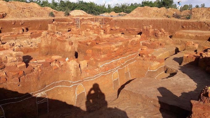
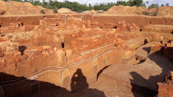
In its golden age, Thành Cha was named Phật Thệ, the capital city of the Vijaya kingdom. It is one of four ancient Champa citadels in Bình Định and was the economic and political center of this region from about the 8th to the 15th century. Thành Cha lies south of the Vijaya capital, in what is now An Thành village, Nhơn Lộc commune, An Nhơn district – Bình Định.
Located on a strip of high ground on the south bank of the Kôn river, Thành Cha consists of two citadel areas, large and small, built close together (also called the inner and outer citadels), both rectangular in plan. In the large citadel, the pairs of opposite walls differ insignificantly in length. When building it, the ancients followed the course of the Kôn river, so the northern wall is about 100 m longer than the southern one.
The eastern and western walls are nearly 350 m long, while the northern and southern walls are nearly 950 m long. Except for the northern side, which has been almost entirely eroded because it is near the Kôn river, the other sides are relatively intact. In the northwest corner of the large citadel there are also traces of a rectangular enclosure surrounding a brick mound in which a very large quantity of bricks and tiles remains, with large door steps and door pillars, and especially many yin-yang tiles and tubular tiles - a decorated architectural material found only in former Champa capitals such as Trà Kiệu.
In this area, a very beautiful bust of the goddess Kabêra Yakshini was discovered together with very finely made terracotta reliefs, evidence of the real existence of a citadel architecture. The small citadel adjoins the back of the large citadel to the northwest and is 134 m wide and 240 m long. An interesting point is that the builders of the ancient Phật Thệ citadel deliberately arranged the large and small citadels in an interlocking layout, shown in that the eastern wall of the small citadel is also part of the western wall of the large citadel, extended by another section.
In the small citadel, no trace of a northern wall has been found, as it used the Kôn river as a moat to form a protective shield. This shows that the small citadel was arranged by the ancients as an outpost of the large citadel, on a very important waterway route. Thành Cha also has many other folk names such as thành Hời, thành Hồ Xứ, thành Bắc, thành Cừ… but the most common name is Thành Cha.
The large citadel lies to the east. The northern wall runs west-east, 947 m long, 3 to 5 m wide on top, and currently about 1 m high. In the middle of the wall rises an 8 m high mound sloping gently toward the two sides of the wall, called gò Cột Cờ (Flagpole Mound).
The southern wall is of similar length but has been eroded and stands only slightly above the ground. The most clearly preserved parts of the relic are the eastern and western walls. The eastern wall runs north-south, 345 m long with an average height of 4 m, and its top is over 30 m wide.
The western wall is of similar length and height but narrower on top, about 7 to 10 m. The northwest corner of the large citadel is enclosed by two wall sections, one running 240 m south from gò Cột Cờ and one perpendicular to it running west, joining the western wall of the large citadel to form a rectangular enclosure. In the middle of this enclosure is a large brick mound, the remains of a collapsed architectural structure.
The smaller rectangular citadel adjoining the northwest of the large citadel is 440 m long and 134 m wide. The Thành Cha relic was ranked a national historical and cultural relic by the Ministry of Culture, Information and Sports on 27 November 2003. Source: National Museum of History